
Tracing a Corvallis Street by Address
No official online Corvallis street directory lists every person along a named street. The defensible Corvallis route is address keyed. First establish the Corvallis parcel through Benton County Assessment. Then use its current property and sales clues to identify the Corvallis map/taxlot, recorded-interest lead, and legal-description language. The recorded-document index is person, document-number, and recording-date keyed, not a street browser. Dated Corvallis directories and newspapers are the historical household layer, while Corvallis civic records have a separate statutory access path.
- Enter a specific Corvallis address in the Benton County Property Account Search. Record the account number, situs address, map/taxlot, and property type before treating a result as the correct Corvallis parcel.
- Open the Corvallis assessment result’s sales history and map/taxlot link. A sale or deed reference is the bridge from an address to a recorded transaction.
- Search the Digital Research Room by the identified party, document number, or recording date. Record the grantor, grantee, document type, recording date, and legal description for the Corvallis parcel.
- For a lawful Corvallis civic-record question, use the Benton Elections formal data-order process rather than treating Oregon My Vote as an open street browser. Released voter data has exclusions and use restrictions.
- For past Corvallis place evidence, compare the printed address in the library’s selected directories and local newspapers. For older deeds, ask for the documented microfiche or microfilm route.
Each step tests a different fact. A parcel and deed trail can show a land interest. A directory can show a dated household entry. Neither produces a complete current list of people who live along a Corvallis street.
Corvallis Street Directory Property Search
Benton County’s official form is the first practical Corvallis street directory tool because it is designed for a Corvallis property address. It accepts a partial or whole address. That convenience needs care: the county warns that 5th can match both 5th and 25th. Start a Corvallis search with a distinctive full fragment and inspect each returned property rather than assuming text matches identify one whole street. The form uses road-type abbreviations such as AVE, ST, DR, PL, RD, CIR, and BLVD.
Property Address is the default mode for a Corvallis search, but an owner name, account number, or map and tax-lot identifier can resolve a search after the initial match. For a Corvallis owner-name search, input follows Last Name, First Name. Account numbers use six digits with leading zeroes. Map/tax-lot research requires a seven-character map number and a starting tax lot, with an optional stop lot for a range. The county’s Albany directional-entry note applies to Albany addresses within Benton County, so it should not be borrowed as a Corvallis street rule.
| Property Account Search field | Format or mode | Street-research use |
|---|---|---|
| Property Address | Partial or whole address; road-type abbreviations | Starts an address-to-parcel search |
| Owner Name | Last Name, First Name; partials allowed | Checks a party lead from a deed |
| Account Number | Six digits with leading zeroes | Returns a known property account |
| Map # | Seven-character map number | Connects an address result to land geometry |
| Start and Stop Tax Lot # | Start required; stop optional | Opens one lot or a defined lot range |
Corvallis Streets Through Taxlot Maps
Corvallis assessment results link a Map Taxlot to the county ArcGIS viewer. That link is useful for a Corvallis street segment because the map shows parcel geometry, not a household roster. Start with one confirmed Corvallis taxlot, pan along the frontage or around the immediate boundary, click an adjacent polygon, and take its MapTaxlot identifier back to Assessment. County GIS lists taxlots, addresses, boundaries, election boundaries, roads, surveys, zoning, and hazard layers. Use those Corvallis layers to understand place and jurisdiction, not to infer personal facts.
The public GIS attributes include MapNumber, ORMapNum, Taxlot, MapTaxlot, ORTaxlot, and acreage. A Corvallis taxlot can be steadier than a street string when an address has changed form or when more than one interest appears under a similar address. The Corvallis City Property Information Lookup adds zoning, historic resources, utilities, floodplain, natural-feature, and other spatial context through an address or county taxlot search.
- Parcel
- A mapped unit of land used in assessment and GIS research. It can have an account and taxlot without being a household record.
- Situs address
- The physical location label on an assessment record. It differs from a mailing or contact address.
- Plat
- A recorded subdivision or survey plan whose lot and block language can help match a deed to the correct land.
- Criss-cross directory
- An address-arranged directory. No verified Corvallis criss-cross volume was found, so do not assume one exists.
Corvallis Street Directory Deed Trail
Corvallis recorded documents must be reached through the party and document trail. The Benton County Digital Research Room has name, document-number, and recording-date routes for Corvallis instruments. Its name search uses a required last or business name and accepts the percent sign as a wildcard in text fields. A first name can narrow a common surname. The document route pairs a year with a document number, and the date route supplies from and to controls. Advanced Search is available, though the accessible inspection did not expose its extra controls.
For a Corvallis street-facing inquiry, use the assessment sales-history deed reference to find the present grantee or other identified party. Capture the Corvallis document number, type, recording date, grantor, grantee, and legal description. Then search the earlier party, reconciling lot, block, subdivision, map/taxlot, or legal-description terms before linking it to the same Corvallis place. A deed chain is a chain of recorded interests, not proof that a party occupied the property.
The historical fallback is unusually specific. State Archives inventory places Benton direct and indirect deed indexes from about 1854 through about 1984 in named holdings. The Avery Land Services Building Self Help Area has listed direct-indirect index microfiche and defined deed-microfilm groups. The county Records Center is not public access, so contact the custodian for the appropriate counter, terminal, or copy path.
Corvallis Street Permit Records
Corvallis City Development Services adds a separate Corvallis address trail. Its permitting database has permits and applications from 1990 and uses Search Cases by address or permit number. The search can accept location house number, street name, owner or contractor name, parcel ID, application reference, and status. Results are organized into Applications and Inspections, with Details for permit or inspection information. These Corvallis records can date work, a reviewed plan, a project valuation, or a contractor association at a place.
For Corvallis material before 1990, the City directs researchers to City Archives, then Community Development, then Address Documents. That online-and-archives split is a practical Corvallis street directory fallback rather than a reason to guess from an absent portal result. Corvallis Development Services can also explain known address questions at its counter. Permit activity does not establish ownership transfer, a complete household, or lasting occupancy.
The Corvallis permit database is the address and permit-number route for the modern City file.
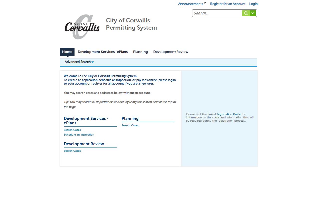
Search results distinguish applications and inspections, which helps keep a location-linked permit record separate from a resident claim.
The City Development Services Information Center documents the 1990-and-later database and the pre-1990 archives route.
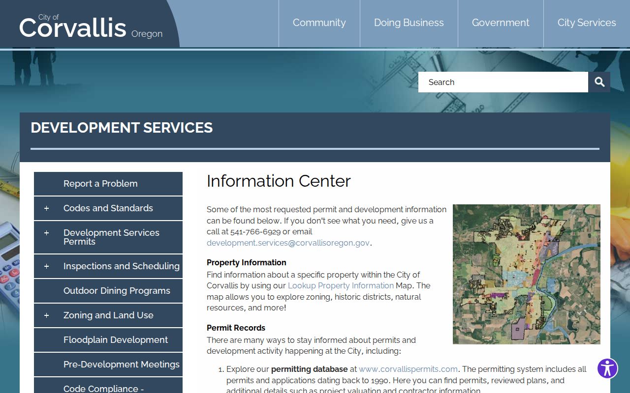
The City resource provides the practical handoff when a document belongs in the earlier archival address collection.
Corvallis Street Grid Records
Corvallis has local addressing rules worth preserving in a Corvallis historical search. City Administrative Procedure 7.08 bases quadrant prefixes on east-west and north-south baselines, including Monroe Avenue and Highway 99W segments. Older Corvallis central blocks retain a 100-numbers-per-block pattern, while much of the remaining city uses one-mile grids with 1,000 numbers divided into ten 100-number sections. These Corvallis rules can explain why a printed historic address needs map, plat, or custodian context before it is matched to a modern parcel.
The Corvallis policy assigns even numbers to south and west sides and odd numbers to north and east sides, subject to continuity exceptions. It reserves numbered streets for north-south travel and uses names for east-west or diagonal routes. Corvallis street names and address changes are reviewed with City departments, County Assessor, Elections, Records, Surveyor, USPS, and utilities. No official source located a Corvallis citywide renumbering chronology, so retain the original dated form instead of inventing a modern conversion.
Corvallis Street Directory Coverage
Address-keyed sources answer different street questions. The table gives the direct access method and a boundary for each source. The property account and GIS tools belong at the beginning because they identify land. The recorder follows a party and document trail. City permits add building or project evidence. Library material supplies dated historic context. A formal voter-list order is governed separately and is not a substitute for a property search.
| Address record set | Corvallis question answered | Access path | Boundary |
|---|---|---|---|
| Corvallis property account | Which parcel and sales lead match a Corvallis address | Address, owner, account, or map/taxlot search | Not a household roster |
| Corvallis Taxlot GIS | Which parcels touch a Corvallis street segment | Map/taxlot link and parcel polygons | Shows geometry, not people |
| Recorded instruments | Which Corvallis parties and documents form a deed trail | Name, document number, or recording date | No direct street browse |
| Corvallis City permits | What Corvallis address-linked project or inspection history exists | 1990-present portal; pre-1990 archives | Does not prove occupancy |
| Historic deed indexes | How a Corvallis past land interest is traced | 1854-1984 microfiche and archive holdings | Requires legal-description checking |
| Corvallis library directories | Which dated Corvallis family/address clue appears | Selected scans and second-floor collection | No verified all-years reverse set |
| Corvallis voter-list order | Which released civic fields can be requested lawfully | Benton Elections form | Protected records excluded |
Corvallis Street Directory Voter Requests
Oregon separates a Corvallis individual’s My Vote account from the public voter-list process. No official consumer-facing Corvallis tool was located for browsing voters by street. Benton Elections accepts a Corvallis data order that can request a walking list, described as names and addresses sorted by house number within streets. The form asks for the requestor organization and contact, how the information will be used, the requested data type, scope, output format, delivery method, signature, and date.
Released Corvallis voter information is defined by ORS 247.948 and protected registrations are removed. A county order can be limited by city, district, precinct, or party within the system’s capabilities, but it is not a shortcut around Address Confidentiality Program or other exemptions. Benton says Corvallis orders are not processed until payment is received and asks requesters to allow five working days. Use it only for the stated, lawful record purpose, not as an asserted list of everyone on a Corvallis street.
Historic Corvallis Street Clues
Maxson’s 1934 directory is an alphabetical family directory, not a verified local street-by-street volume. It lists family names first, followed by address and occupation of the head of family, with rural routes separately grouped. Its asterisk identifies a realty taxpayer checked against a Benton County index. That is a useful hypothesis for a deed or tax search, but it does not establish a current or later household.
The library has verified scans for 1934, 1937, 1940, 1947, and a 1954 telephone directory. Compare an address exactly as printed, then test it against newspapers, maps, tax/deed material, and census releases. The historical collection itself is explored on the Corvallis city directory page; it should not be replaced with an invented criss-cross search.
For place context, the Library of Congress has two May 1884 Corvallis Sanborn sheets. The maps can show building footprint, materials, use, and street-name context in their covered area. They do not name household occupants. The library’s historic maps, register surveys, and targeted Southwest Corvallis buildings-and-people study are additional leads, not citywide occupancy lists.
Limits of a Corvallis Street Directory
A street query cannot reveal all current occupants, confidential voters, utility customers, delivery records, or DMV address data. Oregon My Vote is individual self-service, not a public browser. A formal Benton County voter order has statutory limits, requires the requester to state the intended use, and excludes protected registrations. ORS 247.955 prohibits commercial use of released elector-list information except for its narrow political exception.
Do not turn a property record into a claim about private lives. A situs address identifies the place. A mailing contact, where an official system displays one, identifies a delivery contact. A legal description identifies the land interest. Ask the owning office for a known record and stop when the record is protected or does not support the conclusion sought.